Hiking trip to Trenckova Rokle
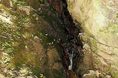
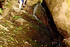
It was a place I was moaning about for quite a long time, but to set off I had to wait for the most favourable weather conditions. Somewhere have I read it should be rainy and wet in order to see the natural beauty of waterfalls close to Trenckova Rokle. Since it was raining cats and dogs for several days before the weekend I thought that would be ideal. Unfortunately it wasn’t enough. It probably should pour heavy rain days and nights to fill the riverbed, so the water can later on fall down in close area of Trenckova Rokle. I heard the best season to visit Trenckova Rokle is either winter, when the waterfalls form beautiful icicles or early spring, when the winter snow melts causing water-basins to fill in.

GPS COORDINATION NEEDED
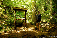
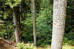
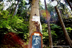
Not only the waterfalls were not as I expected but we also almost didn’t find them. Description I found on the internet led us to the wrong place. We climbed really high, but since there was no sign of any waterfall, we decided to return to Trenckova valley and start looking again. Good idea is to set up GPS coordinates (49˚ 21` 13.15“N 16˚ 22` 30.91“E ) and follow them. If you are not a holder of any device with GPS beware there’s no path leading you directly to waterfalls. Keep in mind that as long as you reach the Trenckova Rokle, go through it and follow the red path for a moment, then instead of turning left on the red path turn right (as I showed on the photo). If you reach the green board with info about the region, go round it on the right side and you will see a rope. If you’re lucky you’ll hear falling water where you stand right now. But you may also climb higher using the rope. There it should be the waterfalls.

PUBLIC RANSPORT
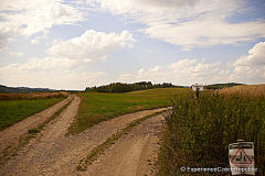
You must be determined to go to Trenckova Rokle by public transportation from Brno. According to idos.cz there’re two possibilities. First, it’s necessary to get to Tisnov, then either choose bus stops to Drahonin or Skryje Boudy. The first option is more frequently chosen by Czech tourists. After this journey, you still need to cover some distance on foot – around 6 kilometers no matter if you choose Drahonin or Skryje Boudy. Don’t forget to check the timetable for your way back. There’s one bus from Boudy/Skryje at 16:49 and another from Drahonin at 17:55 to Tisnov.
BY CAR
The fastest and easiest way is to go by car. We decided to go to Tisnovska Nova Ves as it seemed quite close. We parked at somebody’s private possession as there’s no other option. It’s a tiny village with no parking place. We only parked there as the building was not finished, the owner was not inside and it was Saturday. If not that we wouldn’t have place to leave the car. You may consider going to Drahonin or parking at the Safranuv Mlyn (49°23’37.515″N,16°16’51.470″E), but still you need to go through Drahonin.
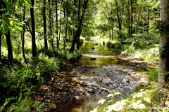
Either way you should look for the red path, which goes along the river Bobrovka.
HIKE
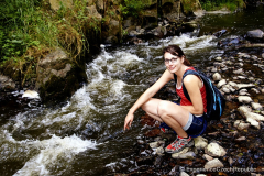
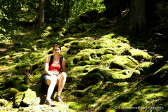
Despite some disadvantages I consider the trip very satisfactory. Hike along the river was vertiginous. Steep descents, high climb, narrow path- everything that didn’t allow you to be bored. Remember to take proper hiking/mountain shoes as it may get slippery in some places.
Share this:

Kunstat Castle
You May Also Like

Swimming near Brno: Ivancice – Letovisko
August 6, 2013
10 top places you cannot miss in Gdańsk
September 1, 2021

